
Locate with Precision, Anywhere, Anytime
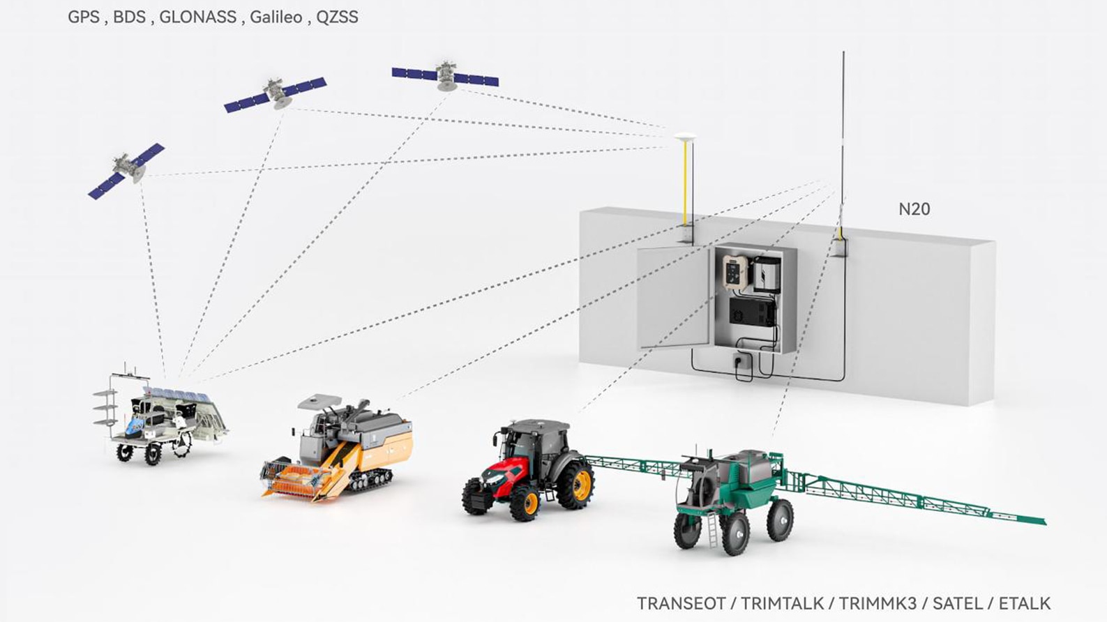
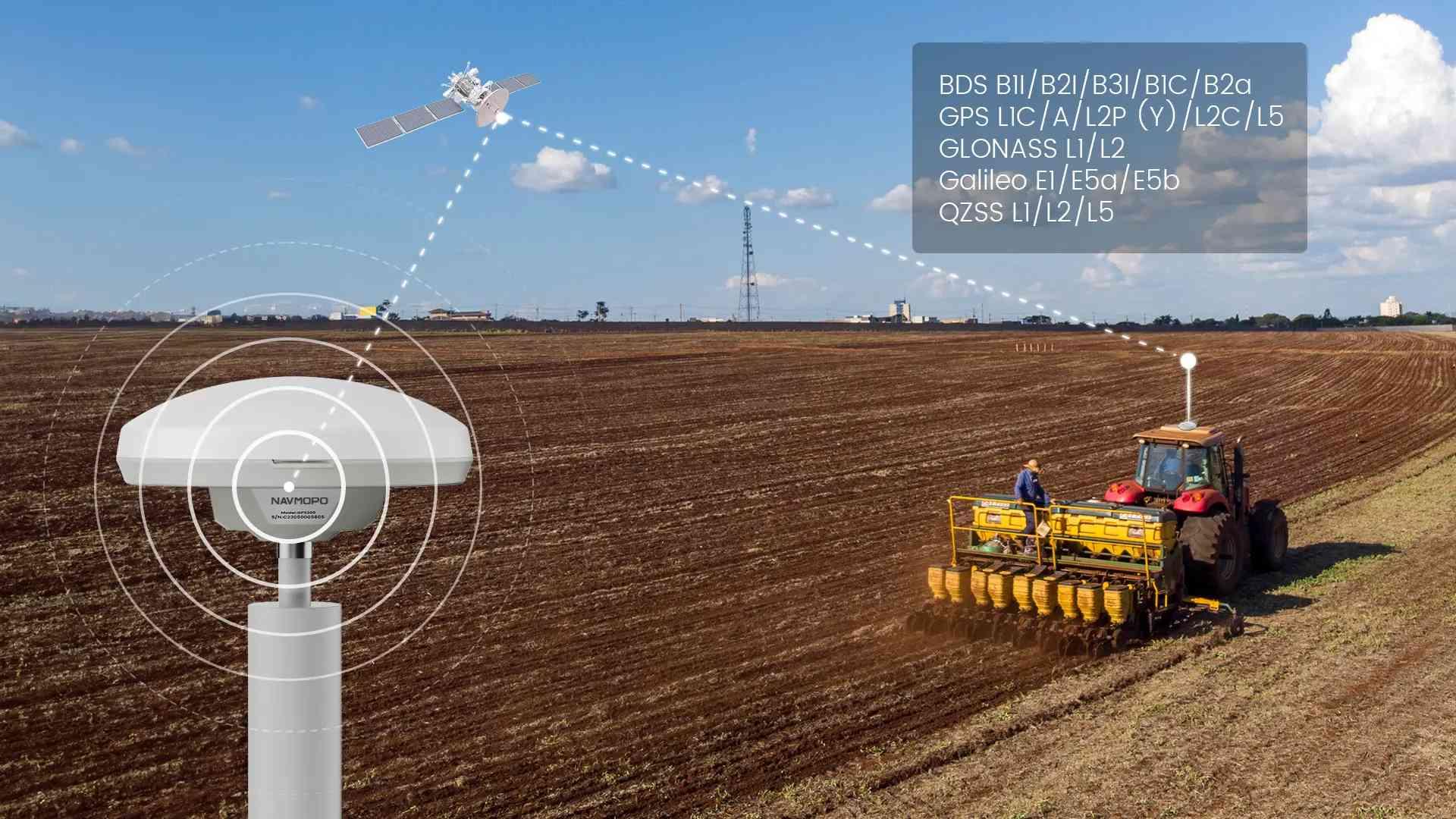
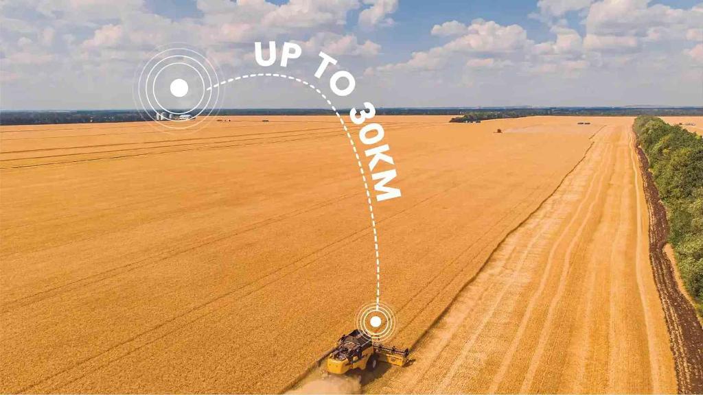
The NAVMOPO N20 is a high-precision GNSS receiver that supports multi-satellite and multi-frequency operation, providing centimeter-level RTK positioning accuracy. Based on the Linux platform and high-power radio, it covers a wide range of up to 30 km under ideal conditions and is extensively compatible with various devices. It is primarily used in precision agriculture, surveying, and mapping fields, making it particularly suitable for areas with poor or no network coverage.

Multi-satellite & Multi-frequency

Wide Signal Coverage

Easy Configuration

Extensive Compatibility

Interference Detection

Uninterrupted Operation
Multi-satellite & Multi-frequency with CM-level Accuracy

User-friendly Operation Experience
Wide Signal Coverage

Interference Detection
Application Scenarios
It supports multiple radio protocols and baud rates, providing a stable signal source for other products. It is also well compatible with devices that have corresponding external radio protocols (frequency range: 410~470MHz, built-in support for 32 channels and protocols: TRANSEOT, TRIMTALK, TRIMMK3, SATEL, ETALK).

NAVMOPO AT2
NAVMOPO AT2 automatic steering system combines GNSS and RTK technologies, which guarantees an accuracy of up to 2.5 cm between passes in any terrain.

NAVMOPO AH1
With the AH1 Hydraulic Autosteering Kit, farmers can harness the power of GNSS technology to unlock 2.5cm accuracy in their steering. By effectively regulating steering oil, the AH1 delivers a precision steering experience, enabling large agricultural machinery to navigate fields with surgical precision.


Contact us to find out more about our solutions for precision agriculture
Specification
Specification
-
Signal BDS B1I/B2I/B3I/B1C/B2a GPS L1C/A/L2P (Y)/L2C/L5 GLONASS L1/L2 Galileo E1/E5a/E5b QZSS L1/L2/L5
-
Single Point Position(RMS) Horizontal: 1.5 m Vertical: 2.5 m
-
RTK(RMS) Horizontal: 0.8 cm+1ppm Vertical: 1.5 cm+1ppm
-
Static Post-processing(RMS) Horizontal: 2.5mm+1ppm Vertical: 5.0mm+1ppm
-
Location Data Update Rate Up to 5Hz
-
Protocol Support NMEA-0183, RTCM3.2
-
External Radio Features Broadcast RTCM3.2
-
External Radio Frequency Range 410~ 470MHz
-
External Radio Protocols TRANSEOT, TRIMTALK, TRIMMK3, SATEL, ETALK
-
ETALK Transmit Power High
ENVIRONMENTAL PARAMETERS
-
Operating Temperature -40℃~+65℃
-
Storage Temperature -40℃~+80℃
-
Waterproof and Dustproof IP67 rated (Receiver, Radio and GNSS Antenna)
ELECTRICAL CHARACTERISTIC
-
Input Voltage DC 9V~16V
-
Complete-built Unit Power Consumption 95 W (10 W for receiver, 85 W for radio)